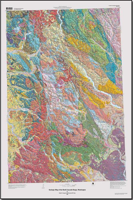
We have the pleasure to announce a new masterpiece of geologic maps of our favorite place has been released, by none other than our longtime associate Rowland Tabor of USGS. Here's a thumbnail of his latest geologic map of the North Cascades. You can download the full version from USGS (but allow some time, it's 35MB).
Haugerud, Ralph A., and Tabor, Rowland W., 2009, Geologic map of the North Cascade Range, Washington: U.S. Geological Survey Scientific Investigations Map 2940
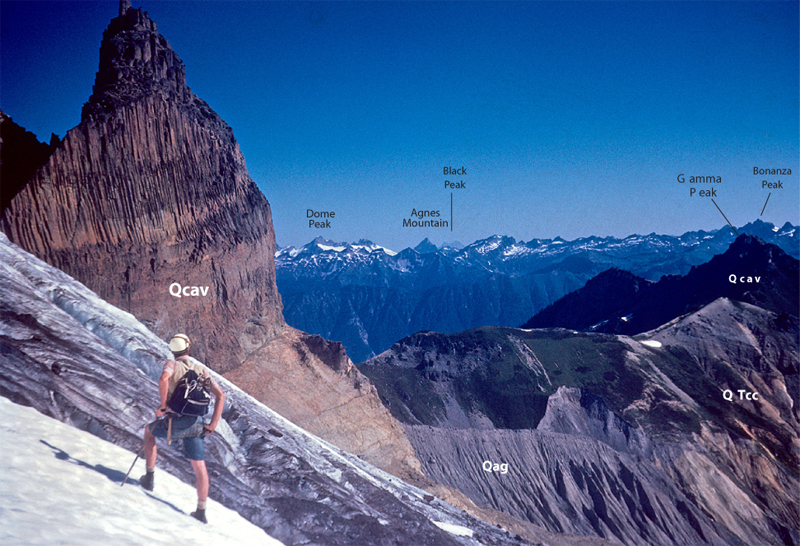
The USGS website Rowland created around this map features an interactive version with photos that identify the various rock types at vista points you may be familiar with. It's like an anatomy lesson on this patch of hallowed ground. Here's just one spectacular example:
 One particularly "cool" map shows how far the ice sheets got during the maximum advance of the last ice age! Here's a thumbnail. CLICK HERE for a full-sized image, and just imagine! The take-away is that the extreme beauty of the peaks of the North Cascades is due in large part to massive glacial action, deepening valleys and sharpening peaks (like the "horn" in the picture above). Glaciers gave the "Pickets" their points!
And don't miss Rowland's classic hiking guide to the North Cascades for those with an interest in geology, now online! Routes and Rocks in the Mt. Challenger Quadrangle You'll find a link to it on the American Alps website's "Field Guide" page.
No comments:
Post a Comment